What’s at Stake as Fires Threaten Mount Hood’s Historic Landmarks and Ski Areas
Every summer since 1924, U.S. Forest Service employees have worked inside the historic Flag Point Fire Lookout in Oregon’s Mount Hood National Forest (MHNF). On July 31, 2026, the high-alpine cabin burned to the ground.
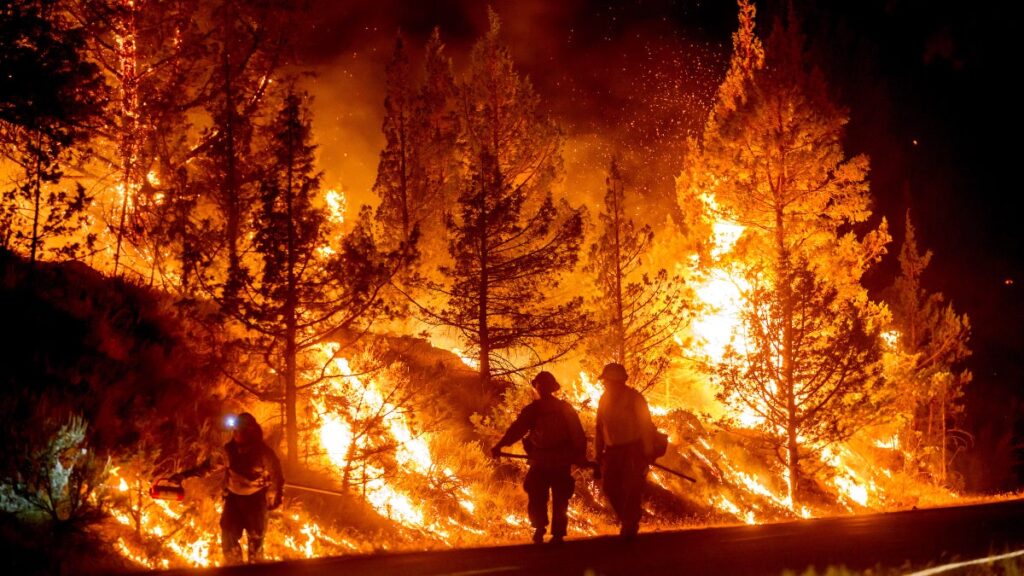
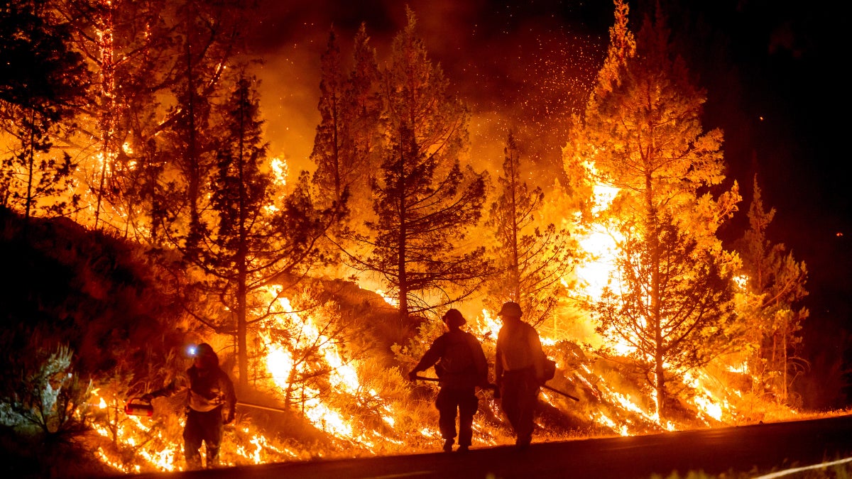
Flag Point is one of many beloved outdoor destinations in the Pacific Northwest to be destroyed or threatened by surging wildfires. The Grasshopper Fire burning east of Mount Hood destroyed the historic fire lookout, forced the evacuation of ski area Mt. Hood Meadows, and closed more than 50 trails across the mountain.
“It’s been hot and dry this whole summer,” Heather Ibsen, an MHNF spokesperson told Outside. Nobody was inside the Flag Point Fire Lookout when it burned because the Forest Service evacuated staff as the fire got close, she said.
But forests, fire lookouts, and recreation sites remain at risk. Officials shut down most of Mount Hood in the middle of its summer season. Mt. Hood Meadows, the largest ski resort on the mountain, is evacuated. Timberline Lodge, a historic landmark built in 1938 on the mountain’s south side, suspended hiking and mountain biking operations. Skibowl, a year-round recreational resort near the town of Government Camp, closed for smoke.
Sparked by lightning on July 23, the Grasshopper Fire has burned nearly 35,000 acres as of August 5, officials said, and remains just 19 percent contained as of the publishing of this story. Roughly 1,300 firefighters and safety officials are currently battling the blaze.
Flag Point Lookout Burns Down After 102 Years
The lookout was one of three Forest Service watchtowers on Mount Hood, and it remained part of the fire detection network, working alongside forest patrols, cameras, and remote-sensing systems. Members of the public could also rent the lookout in the off-season.
Though the Mount Hood community is already mourning the fire lookout, Ibsen told Outside that losing it doesn’t leave a hole in coverage—at least, not yet.
“The in-person fire lookouts are really valuable, but they’re not the only tool we have,” said Ibsen. The Forest Service detects fires using a mix of staffed lookouts, remote cameras, satellite heat data, and firefighters patrolling by truck.
“Go Now” Order Issued for Mt. Hood Meadows
Mt. Hood Meadows is roughly 60 miles from Portland. As the Grasshopper Fire pushed up against its boundaries, officials announced a “Go Now” evacuation—the most urgent—in the early morning of August 4.
“Whelp, we hoped we wouldn’t have to post this, but here we are,” the ski mountain wrote on Instagram following the Level 3 evacuation.
Mt. Hood Meadows President Greg Pack told local news outlet KPTV that a wind reversal caused the evacuation order. Typically, the mountain’s prevailing winds blow west, he said, carrying smoke and fire away from the resorts. But the area saw days of easterly winds instead.
Timberline Lodge Told to “Be Ready”
Officials placed the historic, nearly 90-year-old Timberline Lodge under a Level 1 “Be Ready” evacuation notice on August 3.
“Be aware of danger, monitor local news, and start packing valuables or preparing family members and pets,” reads the notice.
The lodge will remain open unless the evacuation order is raised to Level 2.
Parts of the Pacific Crest Trail Are Closed
On July 24, the Pacific Crest Trail Association (PCTA) announced the effective closure of the roughly 50 northernmost miles of the trail, including the northern terminus and access at Hart’s Pass, due to a wildfire burning to the east of the trail.
Though the Pacific Crest Trail remains open in the Mount Hood area, as of the publication of this story, the PCTA listed the Grasshopper Fire as an alert. The fire is burning east of the trail. Hikers are advised to remember that conditions can change quickly and to check for updates.
More Than 50 Trails Are Closed
The Forest Service has closed more than 50 trails in response to the fires through December 31. These include the Timberline Trail, a 41-mile loop around Mount Hood, along with Elk Meadows, Umbrella Falls, Tilly Jane Ski Trail, Pollalie Ridge, Bluegrass Ridge, Lamberson Spur, Zig Zag, Lost Lake Butte and Surveyor’s Ridge.
Reopening won’t happen quickly. Ibsen told Outside that once conditions stabilize, emergency teams will need to head into the burned area to assess the damage.
“It’s usually scientists and specialists who come in to evaluate damage to soil and the geology and other natural resources, but they do evaluate recreation infrastructure as well,” she said.
Forest staff then use that data to inventory recreation sites and trails, estimate repair costs, and request funding. How fast a trail is repaired depends on where it is.
“How we manage wilderness areas is very different from how we might manage something that is very developed, around a busy campground on a lake,” she said. Some areas may open before the amenities that were there are repaired or replaced. “We want to open up areas to public access as soon as it’s safe to do so,” said Ibsen.
If You’re Heading to the Mountains in Oregon
Check before you drive. Current closures include a block of Highway 35, and evacuation levels shift daily. Consult both the county sheriff’s maps and the Forest Service closure order. You can check air quality at before heading outdoors.
The post What’s at Stake as Fires Threaten Mount Hood’s Historic Landmarks and Ski Areas appeared first on Outside Online.
About The Author