Under-the-Radar Overlanding Spots in the West, According to a Full-Timer
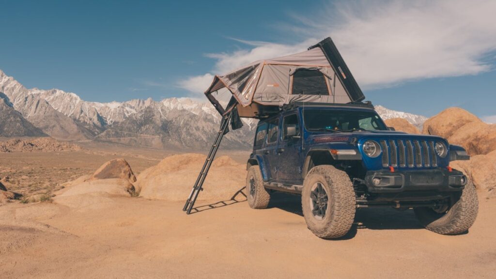

There is a specific moment, usually about ten or twenty miles after the asphalt dissolves into dirt, when the noise of the modern world begins to cut out completely. The cell bars drop to zero, the tourist traffic vanishes in your rearview mirror, and the real adventure begins. But planning a camping trip these days feels almost like buying concert tickets. You wait months for a release date, log onto a park website, fight for a reservation, and ultimately end up with your tent pitched a few feet from an RV, falling asleep to the soul-soothing sound of their generator howling through the night.
Even as a full-time overlander, I’d love to say I gave up on the asphalt lottery long ago, but sadly, for some places, it’s the only way left to experience them. True wilderness is still out there, though. Finding it just means trading the pavement for dirt tracks and exploration.

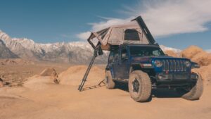
While social media loves to showcase six-figure custom trucks wrapped in tactical gear, crawling through hood-deep mud or hanging off thousand-foot cliffs, the real secret to overlanding isn’t in the extremes. It’s about finding your own beautiful piece of serenity in the backcountry. At its heart, overlanding is simply vehicle-based travel. In other words, using your rig as a mobile backpack to carry your kitchen, bed, and gear deeper into the wild than any paved road could ever take you. You don’t need a custom-built rock crawler or axle-breaking trails. All you need is a dirt track, a map, and your sense of adventure.
When you want to trade packed-out front-country campgrounds for untouched wilderness, finding that solitude usually just means looking where others aren’t—whether that’s adventuring down unnamed forest trails or taking that random side road just to see where it goes.
I can’t give away all my secret spots. But here are three of my favorite under-the-radar areas to get you started on your overlanding exploration list.
The Desert Solitude: San Rafael Swell

A few hours southeast of Salt Lake City’s hustle and bustle lies a massive geologic upheaval, sculpted over millions of years by wind and water into one of Utah’s best-kept secrets. Spanning roughly 2,000 square miles—an expanse nearly the size of Delaware—the Swell makes “massive” feel like an understatement.
The San Rafael Swell is a true overlander’s playground, crisscrossed by hundreds of miles of dirt tracks winding past towering red-rock formations, sweeping desert vistas, hidden canyons, and jagged sandstone ribs. Unlike Utah’s famed Mighty 5 national parks, reaching the heart of the Swell demands some serious off-pavement miles, naturally filtering out the crowds and leaving its wildest treasures to those willing to earn them.
Beyond the driving, the Swell is an open-air museum packed with history. You can spend days searching for dinosaur tracks, hundreds of Native American rock art panels, weathered pioneer homesteads, and abandoned Cold War uranium mines. When night falls, the region has some of the darkest skies in the Beehive State, making it one of my favorite places to stay up until dawn photographing the Milky Way. And once the sun crests the horizon, the adventure shifts into high gear—whether you’re squeezing through narrow slot canyons, tackling desert climbs, hiking rim overlooks, or cooling off from the high-desert heat with a lazy river float.
Every time I head into the Swell, the web of backcountry trails feels virtually endless. The 27–mile Behind the Reef OHV route stands out as a personal favorite, though you can easily link dirt corridors to push even farther—connecting straight into Capitol Reef’s iconic Cathedral Valley or the surreal, lunar badlands of Mancos Shale. Best of all, with the vast majority of this rugged landscape open to free dispersed camping, you don’t just pass through the San Rafael Swell—you get to wake up right in the middle of it.
The Forgotten West: Oregon Outback

While mainstream travelers crowd the beautiful Pacific coast, southeastern Oregon remains one of the quietest stretches of public land in the country. Spanning nearly 30,000 square miles and home to the world’s largest International Dark Sky Sanctuary, the Oregon Outback isn’t a single destination—it is a sweeping, multi-day dirt journey through a forgotten corner of the American West.
Rolling east along lonely gravel ribbons, the landscape unfolds in dramatic waves. On the western edge, sheer 3,000-foot basalt cliffs rise abruptly above sun-bleached alkali lake beds at the Hart Mountain National Antelope Refuge. Camping on the high plateau puts you steps away from Hart Mountain Hot Springs, where you can soak in a stone-lined thermal pool under an endless canopy of stars while pronghorn antelope graze quietly in the surrounding sagebrush.
Farther east, the desert floor gives way to the towering fault-block wall of Steens Mountain. The unpaved Steens Mountain Loop Road climbs past 9,000 feet through shimmering aspen groves, opening up to breathtaking, glacier-carved valleys like Kiger Gorge that feel lifted straight out of the Swiss Alps.
To cap off the traverse, drop down to the Alvord Desert playa, more than a mile below Steens’ summit, then head toward the Idaho border, where the horizon fractures into the Owyhee Canyonlands. Winding dirt tracks drop you between towering, honeycombed volcanic spires and deep river canyons that glow fiery orange at sunset. With cell service, fuel, and pavement fading far into your rearview mirror, this vast corridor rewards prepared travelers with the rarest luxury on the road: total, uninterrupted silence.
The Cascade Crest: Hart’s Pass

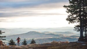
If I hadn’t driven this route earlier this summer, I probably wouldn’t have included it here. Because it sits just east of the famed North Cascades National Park, I assumed the area would be choked with tourists and far from an under-the-radar overlanding destination. One cloudy afternoon, on a whim, I decided to explore it anyway. To my surprise, I passed only two vehicles on the entire climb and spotted just one more at the summit. This area delivers some of the most dramatic views in the entire Cascade Range, yet I had the ridge completely to myself at sunset—watching the day sink behind endless jagged, snowcapped peaks before the sky ignited in fluorescent pinks and oranges.
The highest drivable road in Washington, this single-lane dirt route clings to a thousand-foot-high cliff wall along Deadhorse Point with zero guardrails. That immense drop-off not only demands steady nerves around the blind corners, but also acts as a natural filter, keeping standard RVs and casual weekenders away.
Once you clear the shelf, quiet, primitive campsites sit tucked near the timberline at over 6,100 feet. From camp, you can step right onto the Pacific Crest Trail, or push your rig farther onto two distinct offshoots. The rocky Slate Peak spur climbs steeply toward the 7,400-foot summit area for views stretching to Mount Baker. For a tougher, high-clearance run, Chancellor Road drops down the western slope through rugged, rocky terrain toward the 1890s mining ruins of Barron and the trailhead for the Chancellor ghost town.
Beyond the Map
At the end of the day, the best campsites don’t come with reservation numbers, and they rarely show up on a top-ten list. Use these routes as a launch pad, then keep going—pick a dusty turnoff you’ve never heard of, respect the land you cross, and discover the magic that happens when you leave the crowds behind.
Jay Clue is a professional photographer and Outside contributor who made the switch to overlanding full-time in 2024. Since then, he has clocked more than 50,000 miles exploring the rugged beauty of North America while chasing stars, stories, and dark skies in his custom-built Jeep Rubicon overland rig. After hundreds of nights photographing the backcountry, he can happily report there’s only been one rare occasion when he thought that he was about to be abducted by aliens.
The post Under-the-Radar Overlanding Spots in the West, According to a Full-Timer appeared first on Outside Online.
About The Author